


20210118chapelle

michelelfn
User
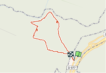

Length
4 km

Max alt
382 m

Uphill gradient
59 m
Km-Effort
4.8 km

Min alt
349 m

Downhill gradient
60 m
Boucle
Yes
Creation date :
2021-01-18 12:09:41.904
Updated on :
2021-01-18 14:31:38.467
2h21
Difficulty : Very easy

FREE GPS app for hiking
 SityTrail
IGN / Geographical institutes
SityTrail Plus
The world is yours!
About
Trail Cross-country skiing of 4 km to be discovered at Grand Est, Ardennes, La Chapelle. This trail is proposed by michelelfn.
Positioning
Country:
France
Region :
Grand Est
Department/Province :
Ardennes
Municipality :
La Chapelle
Location:
Unknown
Start:(Dec)
Start:(UTM)
645682 ; 5512823 (31U) N.
Comments